Hi everyone, writing to you from Baring, WA, a scant 181 miles from the Canadian border. The resident trail angels, the Dinsmores, host hikers before they set off on the last little jump to the border and set them up in their sweet guest house. I was hoping to update in Cascade Locks (the last town in OR), but had to bounce out before getting to the library... and now I'm most of the way through the last state. Craziness.
The end of OR was definitely an improvement over the begining. After leaving Bend, the trail goes around glacier covered Mt. Jefferson and Mt. Hood, the latter of which is home to the historic Timberline Lodge and tons of skiers. The entire mountain seems to be made of ashy silt, like a giant sandpile cut through by the snow-fed creeks from above. These create giant canyons in the dust seemingly held together by the thin stips of trees growing on top. Ramona Falls, deep in a wooded gully and flowing down a mossy wall, was a highlight of the area and flooded with photographers. This however paled in comparison to the Eagle Creek trail, a detour that led down from the mountains to the Columbia River Gorge at Cascade Locks. The path is famous for its waterfalls, which tumble from all sides down a narrow basalt canyon. The tread itself is often blasted into the rock, and indeed tunnels behind a 150 foot cascade at one point. Needless to say the trail is popular with day hikers, especially the cliff jumpers who make use of the deeper pools. All in all, its one of the highlights of the entire PCT.
Cascade Locks itself is conveniently located directly on the trail after Eagle Creek, and holds the distinction of being right on the border of a new state. Given how long we were in California, Oregon seemed to fly by. From here the trail crosses the Columbia River on the Bridge of the Gods at an elevation of 180 feet, the lowest point on the entire trip. Unfortunately, WA seems determined to make up for the flatness of OR before it; immediately upon entering the state it takes a roundabout route that climbs more than 5000 feet somewhat needlessly.
Thankfully the state has redeemed itself fom its less than auspicious beginings. Though it tends to be much steeper, and the climbs more frequent, WA has been pretty stunning. The north Cascades are awesome, rugged and rocky below, clothed in glaciers above, and peppered with wildflowers all over. Mornings and evenings are cool and often shrouded in mist, making for good hiking in the eerily silent and still air. The Goat Rocks and Alpine Lakes Wilderness are other areas I would love to revisit, each offering great views, plenty of secluded camping and crystal clear water.
Personally, I view this hike as an oppotunity to scout out places I'd like to spend more time in, not as a relaxing experience itself. Ed, Straight Jacket and I have been at the head of the crowd for awhile now, hiking alone but always in the vicinity of each other. Waking up at 4:30 a.m. and going until after 7 p.m.or so with maybe an hour and a half of rest, we've all been pushing 40+ miles a day. While to some it seems like racing, honestly it is simply hard to put the brakes on ones momentum. Knowing that your legs can go farther in a given day, it almost seems insulting not too, like they are entities of their own. With only 181 miles left to go, I hope to be finished in just 5 or 6 days, then who knows what comes next.
About Me
- Animal Entropy
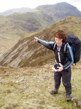
- Was living in NYC doing the waiter thing, then hiked the Appalachian trail in 2008, then came back to NYC to do the waiter thing, now leaving for the the west coast to do the Pacific Crest Trail. Oy.
No comments:
Post a Comment