Wednesday, September 17, 2008

The Rest of the Story

So, here it is.  Finally.  Several weeks after the fact.  Yes, I finished the trail, on August 21st at about 5:18 a.m.  If you are reading this and didn't already know that fact, um, where have you been?  I for one have been bumming around home, doing the odd chore and working alittle in the meantime, but more on that later.  Lets rewind, say, six weeks to my last post when I was taking a break from the physical and mental punishment that was southern Maine at the Andover guest house...
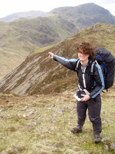
     Heading out of Andover was tough, given the terrain we had just come through, and of course, the weather.  The only comfort lay in being told that things got a bit easier farther into the state, but those rumors usually proved unreliable.  The rain kept up to some degree or another for most of the remainder of the trip; everyone joked that we wanted some rain, just a little, every day just so we could say it was wet all throughout, but fortunately that didn't happen.  For all the tough terrain, the backbreaking climbs, and the constant mud, Maine definitely made up for itself with scenery both awesome and subtly beautiful.  The rain made the many rivers swell, making the fords more difficult, but also the waterfalls grander and the water pure and plentiful.  The crossing over the Kennebeck River required a ferry in the form of a canoe, captained by... well exactly the kind of character you'd expect to be plying a flooded river in the rain with a boat full of smelly people, Robin Hood-esque hat and all.  
     Many of the hikers, myself included, felt Maine was a good time to pamper ourselves, and as such I took several stops, one in Stratton and another in Monson, at the latter of which I was treated to a stay with the family of one of my mom's co-workers.  They happened to own a summer home on a lake near the trail and put me up for a night.  It was a nice getaway, and one in which I got to bask in the mild celebrity of being a AT hiker for one of the last times.  Throughout much of this area, I was playing leapfrog with Mangey Moe and Beershake, an ultralighter who I had seen numerous times before realizing that I had met him before; he worked at the EMS store in Fairfield where I bought some equipment and was finishing a hike he had started last year. I also finally caught up with Chris the New Guy, someone who I had hiked with in Virginia but got ahead of me when I stopped for some family visits.  Who knew that over 1500 miles later we would be reunited and finishing the trail together.
     Leaving Monson, we entered what is ominously and erroneously called the "100 Mile Wilderness", supposedly for its remoteness and lack of roads.  In reality, several dirt roads with possible resupply crossed the trail, but the area definitely had a quieter air to it; gone were the distant rumbling of trucks on the highway. audible even is the valleys .  At this point, the weather cleared to near perfect conditions and the trail dried out some, making for great hiking.  Because of this, and due to the fact that mom and Ryan were coming to pick me up at a later date than I anticipated, I took my time, finally being able to enjoy the views without getting soaked.  True to the rumors, the landscape eased somewhat as we walked along several lake and narrow canyons filled with waterfalls.  I indulged in one last stop at a hostel called Whitehouse Landing, situated on a lake and home to the famous 1-lbs burger as well as a family of loons.  Listening to the loons cry at night, so close to the end of the hike, was the first real heartbreaker moment when it became apparent that thing would have to end soon.  
     The last few days were ones of reflection and anticipation.  After more than 4 months on the trail I was ready for a few straight days of sleep in my own bed, but with the weather cooperating, I didn't want things to end.  The rest of the world beckoned however, and so somewhat reluctantly I pushed on.  After all that time, slogging through rain and wanting to be done, once you get that close it seems far too soon.  The approach to Katahdin offers several views of the mountain and a walk along the Penobscot River before finally entering Baxter State Park.  With little fanfare we all signed the register as family-bearing SUV rolled into the parking lot.  
     The last night on the trail, there was no partying or huge celebrations, just a modest fire.  It was a good crowd for the most part, with Chris, Timeless, Barefoot Sage, all people I had hiked with briefly at one point or another, as well as several others.  Chris's and his father, who had arrived the day before, were going to attempt to reach the summit for sunrise and I decided to try as well.  Leaving at 3 a.m., we donned headlamps through the forest and set off.  Being anxious to reach the top in time for the big show, I left them behind as the trail started to become more difficult.  Once above treeline, the clear skies and near full moon made for eerily beautiful and bright views, but also reduced the temperature to what felt like near freezing.  Huge wind gusts buffeted me around as the trail climbed over and around cold and rough rocks.  The top of the mountain is a small plateau, offering some rest for the last push, up more jagged ground to the real summit, surmounted by an artificial  pile of stones to push the peak to exactly a mile high.  From the top, you have a breathtaking view; there are no nearby mountains to speak of, and the plethora of lakes reflect the rising sun as the lights of Millinocket, the only nearby town start to wink out.  To the west, the shadow of the mountain loomed large, projected into the morning mist like a dark, intangible pyramid.  
     I lingered at the summit for a good hour, freezing and entirely alone as Chris and his dad were taking the ascent very slowly.  Somewhat worried about them, I started heading back only to encounter them on the open plateau well after the sun had risen and the air started warming.  I decided to head down a different trail than we ascended, the Abol Slide trail, essentially 3500 ft. straight down a former rockslide.  Looking down, you can just tell the next hour or two of your life is gonna suck, but by that point, I was beyond caring.  I had finished the trail, what did it matter if I broke some bones on the way down?  I reached camp at the base around 8:30, just as the day hikers were starting their climb, much to their chagrin and my delight.  I definitely got some strange looks for coming down the trail so early.  
     I got a ride out to town with Chris and his parents and checked in to the hiker hostel there.  Mom and Ryan came up the next day and we went on a short hike in the park down to some waterfalls and got to see 3 moose, all in the span of about 5 minutes.  The next day we went whitewater rafting on the Penobscot, which is always exciting but also tiring; afterwords I declared I was done with physical exertion into the foreseeable future and jumped in the jacuzzi.  Then, it was over.  We left for CT the next day, I slept most of the way, and woke up back home, been here since.  
     So there it is.  The dry account of things.  Riding home I had so many thoughts, so many ideas to put here, but putting those feelings into words is another matter.  I think thats enough writing for now, hopefully I'll get some more meaningful thoughts in here in the near future.  Peace out, yo. 

Thursday, August 7, 2008

Oooouch

I'm just gonna come out and say it; Maine is hard. At least this first part is. We've been travelling through the Mahoosuc Range, which, though not as tall or steep as the Whites, presents plenty of challenges. The Mahoosuc Notch, famously known as the hardest mile on the trail, didn't disapoint. Its a dramatic climb over, under, and around boulders through a narrow pass, and any fall could result in being stuck in ice (yes, ice in August) filled crevices. A moose skeleton adorned with prayer flags, the remnants of an accident last year, is a testament to its difficulty. Spectacular yes, but challenging to say the least with a 40 lbs pack, and followed immediately by the tiring Mahoosuc Arm climb.
Next came Baldpate Mt., possibly the most dangerous ascent so far. The thermometer read 50 degree at the base, but with a completely bare summit, sustained 70 mph winds, horizontal rain and, slick rocks, the threat of exposure was great. Several swollen stream fordings have followed, as well as a climb up a mudslide-swept rock face have rounded out the difficult terrain.
By far the greatest challenge however has been the rain. The constant, constant rain. It's very demoralizing to realize that all the effort to reach a peak is wasted on clouded in summits, disheartening to give in to the fact that your gear is never going to be light and dry again, and maddening when every climb feels like cross-country skiing uphill on mud. The moisture is all pervasive, as is the feeling of being perpetually pummeled, and worst of all is the fatigue of always being strung out on adrenaline from slipping on slick roots. Its strange to talk about getting seasonal affective disorder in the summer, but there it is. The rain doesn't look like it will let up soon, but the terrain is supposed to get easier, and with only 255 miles or so to go, there is no turning back now. Every moment of sun is an unexpected surprise now, and an iron will can't be rusted. On to Katadhin!

Sunday, August 3, 2008

Escape Velocity

Escape velocity is the term I use to describe the relative willpower needed to get out of a trail town or rest area after stopping; how tired you are, how nice the town is, who you are with, etc., all affect this. Since arriving in NH, I've been fortunate enough to get two family visits and currently am in Gorham with my brother and his girlfriend for a day. The hiking in this state has been by far the hardest we've encountered, but also the most rewarding with spectacular views from mountains above treeline, awsome waterfalls, and the opportunity to stay in "huts", essentially mountain lodges staffed by a "croo" that have home cooked food and running water.
All this would be great, were it not for a stomach bug that I seemed to have picked up and the fact that we've been getting wailed on by rain at some point every day. Couple that with the tough climbs, mud, and rock walls one expects to find here and I've been hurting an inordinate amount. The fatigue and joint pain associated with ascending and descending so steeply is nothing I'm not prepared for, but the lack of appatite and subsequent lack of nutrition is somewhat disconcerting. Coming into a town and not being hungry is completely foreign to a hiker, and the fact that lately I've been hitting the bottom is even worse. For 1800 miles I've been able to dig and push up hills as long as I replace the energy; for a few days that seemed to not be the case. Luckily I'm sitting here typing this and my stomach is telling me its time for breakfast in a big way, so hopefully the worst is past. Giving the terrain I have hanging over my head for the next coupla days, I'm gonna need alot of power to get to escape velocity.

Friday, July 25, 2008

Forgot My Swimsuit...

Sitting here in the Comfort Inn in Lincoln/ Woodstock NH with mom and grandpa here for some traveling fun and it defintely feels good to be inside for a bit. Just saw the new Batman movie as well, and yes, its incredible. Not just the movie, but the fact that I am dry and my clothes no longer smell like mildew. The trail through NH has been largely underwater due to heavy rains for the past few days, but thankfully that has cleared up and it looks like clear hiking right now. I don't just mean a little water; I'm talking puddles a foot deep in places and small waterfalls coming down slopes. After a few minutes walking in such conditions, you just give up trying to stay dry and then the fun of splashing through the wettness for 8 hours sets in. Even sleeping damp becomes somewhat normal, though admittedly I did get to cheat a lil', knowing that I'd get a day in town. Redgardless, I have the hard stuff to look foward to for the next few days, and in muddy conditions to boot. Fully rested, restocked and removiefied, its time to finally tackle the White Mts. and enjoy the awsome views. Even from down below the mountains look impressive, so a few good views from the top will make it all worthwhile. Just gonna soak up the relaxation for the minute, then begin the final push!

Tuesday, July 22, 2008

4 States in One

Wow, um, so I guess the last time I posted was in NJ. And now its VT. And almost NH. Sorry about that, you know how busy things can get out here...
Where to start? Once again, I have to be brief, so just another quick rundown I'm afraid. NY was tougher than expected, lots of quick ups and downs coupled with poorly blazed trail and ample rock climbing made for some very tired shoulders. The trail passes close to some parks popular with city vacationers, and seeing as I was passing by on the 4th of July weekend, the area was packed with loads of picinickers making a mess of the place. Fortunately I had a good private seat atop Bear Mt for the fireworks from several towns, which was followed by a trip through a zoo complete with a Walt Whitman statue and some quotes from "The Song of the Open Road", a strangely emotional experience. A quick side trip into Stormville, the home of a regularly occuring flea market that my mom and I sometimes visit wasa nice change of pace as well.
Next came a trip over the Hudson and on into CT. Despite having grown up there, I'd never actually set foot on the trail in the state, much to the consternation of the other hikers looking to glean info on its terrain. I was pretty happy with how it shaped up, with fairly easy climbs but nice views and lengthy walks along the Husatonic river. I was fortunate enough to get to hang out with my cousin Becky at her house near Salisbury, where she works at a horse stable. Mom came to hike for a day and a half and put in a solid 18 miles over Bear Mt (a different one :-P) and into MA, where we met my brother and had a nice lunch. I consider myself very lucky to have such support and hospitality that I can draw on, and try to spread things around whenever I can. The hills have been becoming more severe, a prelude to the White Mts which have been hanging over our heads, and this next state was the beginning of the tranistion. The towns which we've been passing have been frequent and well placed however, and with home so close, I haven't had to worry about resupply lately. As such, MA seemed to fly by.
VT has been amazing so far, and I'm glad to have finally slowed down to some degree. The Green Mts here are challenging enough, but there are harder peaks to climb yet, and harsher weather to boot. Regardless, it is all worthwhile to see the pristine mountain lakes, the great views from atop firetowers on wood shrouded hilltops, and the ever changing flora and fauna. Oh, and the ice cream. VT has some sweet scoop shops with locally made stuff, very choice. Furthermore the pool of hikers has been more diverse; the AT runs concurrent with the Long Trail, a path running from the MA border up to Canada, for about 100 miles, and as such we've met alot of new hikers there. Even more exciting are the southbounders which have been passing in waves. At every opportunity we seem to be grilling each other for the best places to stay and eat, as well as any other valuable info. It doesn't always quite work out so smoothly, as is evidenced by my stay at a hostel in Rutland run by a very friendly, if slightly cultish, Christian community that resulted in some awkward situations. Lets put it this way; I don't dance well to any music, much less joyfull piano musicwith religious singing in the background.
Having passed the 1700 mile mark, I will say my body is starting to get a little tired. While the hiking can get easier, it never truly get easy, and from what the southbounders have to say, its going to start getting very tough indeed. Thankfully, the payoffs more than make up for the effort and we'll soon be heading into the most stunning part of the trail. Hopefully I won't get so lax again, hope everyone is doing well!

Wednesday, July 2, 2008

Summer Slowdown

I'm in Vernon, NJ, at the moment, taking a break and beating the heat of the day at the church hostel here. Now that home is a mere few hours away and summer vacation has started, I'll be seeing more family, and so I've decided to slow down...just a bit. Hopefully this will make it a lil' easier to meet up with people, and give me more time to take advantage of the berries in season, oh yeah! On that note, I'm hoping to hit Bear Mt, NY, on the 4th, where supposedly one can see the NYC skyline and the fireworks. After that, a quick side trip to the Stormville Flea Market with mom for some good ole' junk scouring, then on to CT. NJ in the meantime has been surprisingly wonderful-- few rocks, level terrain, nice ridgeline views, lots of bears, and a cool boardwalk through a huge swamp, all in a tiny state with just 72 miles of trial. The new shoes I picked up in Delware Water Gap are taking some getting used to, but aside from that the trail is going fine and the weather has been the usual summer sun/thundershower mix. As usual, hope everyone is feeling well, talk to you later.

Sunday, June 29, 2008

PO'ed in PA

Ok, so I'll admit, I cribbed this title from a series of comics drawn by this guy "Butters" on the trail. He leaves them in every trail register and they're pretty consistently hillarious, so I figured I borrow it for today. Its hard to believe that the last time I posted was in Harper's Ferry, WV, yet now all the sudden I am here at the end of Pennsylvania, and none too soon either. We're all tired of the state and its near constant rocks, though there are few hills or other major challenges to get in the way. The terrain in PA was one of the trail rumors everyone's been hearing about for hundreds of miles, and they don't disappoint. While the worst bits didn't start until a few days ago, my feet have been getting roughed up with every mile of walking. But, instead of complaining, I'll just go back to the beggining and spare you.
After the long haul through VA, the states of West Virginia and Maryland blew by like a breeze. After leaving Harper's Ferry, we got a nice stroll along the C&O canal path, the same trail that heads through Georgetown in D.C. It was nice and relaxing, with the Potomac on one side and the tranquil canal on the other, but once again made me miss the city. We had a few parting glances from the cliffs back down the river before heading into MD, which was full of Civil War history and old momuments, including a small stone one to George Washington. Nothing to rival its bigger cousin, but something cool to see anyway.
We passed into PA, which started benignly enough with some easy ridge trail that gave way to the farms of the Cumberland Valley. State parks were sprinkled along the way, including the milestone Pine Grove Furnace Park, where the official half-way point is located. Its also the home to the "Half Gallon Challenge", where hikers routinely down a box of ice cream in a minor gastronomic feat that inevitably leaves one sprinting for the bathroom (chocolate chip cookie dough for me, in a measly 30 minutes; the record is 4:30 or so). The flat land afterward was a bit disorienting, walking across the fields with corn growing on one side and wheat on the left or wading through grass grown head-high, the hills receding for a short time. Luckily the trail passes straight through several towns, including historic Boiling Springs with many preserved buildings and a clear lake in the center. Several of us got to witness a wedding at a gazebo right off the path; the coupled walked down the aisle on the same trail we'd been following for 1,100 miles. Next came Duncannon, a slightly less charming town on the Susquehanna (sp) River, home to the seedy yet legendary Doyle Hotel. In a great stroke of luck, Anastasia came to visit on here way back from a wedding in WV with a friend and we got to have a few drink together. On the other side of the coin, I got an egg thrown at me on the way back to my campsite; a glancing blow to the foot, but annoying none-the-less and asign that not everyone understand that they have something unimaginably cool going right through their home town. I'm eternally gratefull that I didn't grow up in that particular burg.
The rest of the state proceded along ridgelines and down into the river vallys between, passing through Port Clinton and skirting the rememnants of an envirnmental disaster outside Palmerton, where years of zinc mining and smelting left the hills denuded and dead, a wasteland with a view. From there on out, our feet became punching bags, constantly getting beaten and twisted by rocks. I was fortunate enough to fall in briefly with a group of fun people, so at least themisery was shared, and now I've been relaxing the past couple of days with my mom and brother who met up with me in Wind Gap and did some hiking with me today. There's been tons of food, a gradual lessening of the rocks, and some nice downtime and company, as well as some new shoes and gear to take me the rest of the way. Now that the tough terrain is gone for the time being, I should be flying along from one visit with friends and family to another. I'm looking foward to seeing and meeting more people as I go north, the next few weeks should be a fun time... until the White Mountains at least anyway.

Tuesday, June 17, 2008

1,000 miles and feelin' fine

I'm here at the ATC headquaters in historic Harper's Ferry, WV, having passed the 1000 mile mark sometime earlier today. In addition, we finally passed out of VA, having come some 535 miles through the state. While its not quite the physical half way point, the town still holds a special place for hikers on the trail, and it defitinitely feels good to be here, and to be able to add another state to those finished. The area is beautiful, filled with old buildings and situated on a hill where the Potomac and Shenendoah Rivers converge, and luckily the weather has cleared up after a thunderstorm hit last night. The last few days have been eerily sparse as far as other thru hikers go, so I'll be trying hard to catch up with a few guys who got ahead of me in Front Royal; hopefully they aren't hurrying through the area, as I would like to spend some time in town. With D.C. so close by, NYC approaching, my stay with my sis in Front Royal, and my mom coming to visit soon, I have lots to look foward to in the coming weeks. The states and the miles should be coming fast now, time for the second half to begin!

Sunday, June 15, 2008

Through the Shenendoahs and Beyond

Just saying hi from scenic Front Royal, VA today, the last stop in this state and the end of the Shenendoahs. The last week has been like hiker vacation with easy trail, easy grades and lots of available food from the restaurants scattered throughout the park. Got to meet lots of tourists along the way and educate people about the trail a bit which was fun; its kinda like being famous, but more smelly. Saw a total of 13 bears, countless deer, some woodchuck and racoons, tons of great views and had mostly fair weather. The mountain laurel was out in full force lending its distinct scent to every step, but unfortunately we were a bit early for the blackberries and such which also crowded the trail. I also had the chance to night hike for a bit which really is a different experience, getting to see the lights of civilization coming to life off in the distance from the ridges and with thte clear weather and full monn approaching, will be doing more of that soon. Met some new people as well and passed some others, but after taking a few days off in town here with my sis, I'm sure I'll be seeing them all again soon. Well, gotta run, next stop is Harper's Ferry then on into Maryland and Pennsylvania. Getting closer to home every day, hope to see yall soon.

Monday, June 9, 2008

Strenous Yet Satisfying

Writing to you from Waynesborough VA here on a sunny, breezy day. Alot has happened since my last post, but I might save some of it until I have more time to write.
Just a note, I usually use the word "we" when writing despite the fact that I usually hike solo. This is due to the fact that we all hike the same trail and go ver the same hill, visit the same towns, stay in the same places, etc. Even though I'm not really traveling with anyone in particular, it doesn't feel right to use the word "I", so there you have it.
The biggest challenge so far has been getting over the fact that VA is in fact not very flat. Many past hikers have told us so, but after making repeated 3000 foot climbs in stifling hot weather it has become apparent that that was a hoax. The trail paralles the Blue Ridge Parkway and is often no more than a hundred yards from the smooth, well graded road, yet we have to climb steep and rocky hills with no views; those are reserved for motorists it would seem. Couple that with the near incessant flies, the deteriorating boots, and sky high humidity, and VA has been anything but easy so far.
Regardless of the challeneges though, the trail has been rewarding. Some great views so far have been at McAfee's Knob, an outcropping with 180 degree views and a perfect sunset, as well as Tinker Cliffs, Hay Rocks, and Cold Mountain. Every day has afforded the chance to bathe in some cool creeks and under waterfalls, sample some wild strawberries and honeysuckle and see more deer than I can count. We've camped by mountain ponds filled with peepers, bullfrogs and birds, crossed the longest footbridge in North America over the James River, and met a Trans-Continental cyclist with his own traill stories to tell.
Furthermore, there has been a ton of trail magic lately to ease the hiking burden. At Thunder Hill shelter, a local man was cooking pancakes, eggs, and sausage for 8 hungry hikers, in the rain. Several times people have left coolers with drinks or given rides into town. And best of all, at Hog Camp Gap, shortly after completing a crippling climb in 90 degree weather, we stumbled upon a tailgate party held by past hikers with tons of free food, drinks, and music that lasted all weekend. It was very difficult leaving before the festivities broke up, and as result the last few days have been pretty solitary, with most people in town or at the party.
Next up is Shenendoah National Park, a hundred mile section before coming to Front Royal and the end of VA where I hope to take a day or two off and possibly see some old faces. Geoff, Bad Dinner, Bone Lady, Wild Oats, Tetris, New Guy, Mike, Wookie and Wasabi are all behind me somewhere, but theres 1200 or so more miles to go so I'm sure I'll see them all again sooner or later. It shouldn't be too long before I post again, but take it easy in the mean time.

Tuesday, May 27, 2008

Love Letter to VA

Having come another 160 miles from Damascus, I'm now approaching the middle of VA and have started to get a taste of what it has to offer. Unfortunately, it offer puds. Lots of them. Up and over the viewless Brushy Mt. 4 times in 2 days? Sure, sounds lovely!! Its begining to become a little more obvious why many people drop out here; with the warm weather comes more leaves and the onset of the notorious "long green tunnel" effect. Don't get me wrong, its a lovely place to walk in for a day or two, with quaint fields and pastures, great rivers, old farms, tons of flowers and the accompanying scents and colors... buts its hard to keep pushing during the day when every aspect of the scenery begs for a Hucklberry Finn-style nap with a straw hat pulled low over the eyes.
Luckily it hasn't all been so mellow, as the ascent of Mt Rogers and the Grayson Highlands afterwards were both awsome. Open upland meadows, half wild ponies and 70 mph gusts of wind tend to keep things interesting, as do ankle murdering rocks. Dismal Creek Falls was fun and accompanied by some welcome trail magic in the form of some vacationing Virginia Tech. students who brought and shared some bbq, as was the unexpected hitch into the town of Bland. Yes, a town called Bland. Luckily the company was good and the hitch back to the trail was fast, so it didn't sidetrack things too much. Nice views from the aptly named Angel's Rest down to Pearisburg where enough to whet my appatite for civilization to the point that I overshot the turnoff into town and had to hike several miles back, but it was all worth it for the resupply and a pint of ice cream.
I'm still making good time despite some earlier ankle pain which seems to have largley resolved itself, so now its just a simple 340 mile jaunt out of VA. Front Royal,VA, (zip code 22630) is my next big stopping destination, where word has it my sis has secured a sweet pad from one of her coworkers at the zoo; I'm reserving the shower in advance. Their animal rehabilitation park is out near the trail, and its should be one of the cooler sights on the trail through this state, so I'm definitely looking foward to it. After that is Harper's Ferry, WV, (zip code 25425), the spiritual half way point of the trail, and the point where the terrain and place names start getting a little more familiar. DC, NYC and CT get closer with each step, so remaining motivated isn't a problem. I'll be seeing everyone soon, but due to the awfull cell phone reception in VA so far, I can't promise how in touch I'll be. Regardless, messages are always welcome, and I hope everything is well in the real world. Talk to you all later.

Backlogged stuff

A few more vocab words before I start.
Hiker midnight - any time after dark (usually around 9:00), when everyone starts passing out
Hiker cologne - Smoke from the fire. Because lets face it, anything smells better than a hiker at the end of the day
P.u.d. - Pointless up-and-down. Any ascent that yields no worthwhile views, no shelters, no water, and is generally monotonous. VA seems to specialize in these.
AT -Shorthand for the Appalachian trail, obviously
2,000 miler - anyone who has completed the whole AT, regardless if it was in one year or over many
PCT - Shorthand for the Pacific Crest Trail, a 2,600 mile trail in California, Oregon and Washington. Higher elevations, less water and more drastic weather make it more logistically difficult than the AT, but an easier trail grade and less rocks and roots makes it less physically demanding.
CDT - Shorthand for the Continental Divide Trail that follows the Rockies for the most part, also from Mexico to Canada. At 3,100 miles, it is the longest, hardest, and least traveled of the long trails in the US.
Triple Crown - Title awarded amongst hikers to someone who has thru-hiked the AT, the PCT, and the CDT

Hi everyone, writing to you from the library in Pearisburg, VA. Seeing as I never got to update after the end of Trail Days in Damascus, I'll just give a quick recap of some of the... more colorful moments.
-The hiker parade, where everyone arms themselves with water ballons and squirt guns and its an all out war of hikers vs. townies
-huge bonfires every night at multiple camps, each with their own flavor; some drum music, some bluegrass, some storytelling, etc.
-An impromptu list of a typical days fluid consumption; beer, bloody mary, beer, margarita, beer, vodka lemonade, beer, beer, water. Its just the most available drink, what can I say.
-Hilarious D-list horror movies about a killer grizzly bear. Best movie special effects ever (and yes, they are fake)
-Inspiring (if somewhat cheesy) movies about the CDT. Triple crown here I come!!
-Hiker talent shows, the useless gear competition, eating contests, free home cooked meals, and all the drool worthy gear you could lays your eyes on.
-Lazy days by the river and lazy nights under the stars till 4 a.m., hiker midnight be damned

Friday, May 16, 2008

Lazy Days

If anyone doubts the relativity of time, they should become a hiker. On the way into Damascus, Mike and I hiked 26 miles before 3:45, an impressive feat. Now, at Trail Days, time seems to go so slowly (a good thing out here), and hours can be spent just chilling around the fire, meeting new people and seeing old ones. We've all been taking advantage of the free events in town; food, movies, talks and impromptu parties seem to be the norm every day, and the festival has barely even started. The weather has bee a little crappy, but rain and wind does little to dampen the spirits of thousands of hikers, especially when copious amounts of beer are involved. Without too much to do or write about, I thought I'd start a little glossary of trail terms for everyones amusement. Feel free to skip ahead if this is stupid.
"white-blazing"--a hiker committed to hiking 2,100+ miles of trail along the official route, which is marked with white blazes. I'm one myself, and while I don't consider myself a purist or anything, it just seem to be the most authentic way to do things.
"blue-blazing"-- taking side trails off the official route marked with blue blazes. While there are numerous loops that add milage in order to incorporate somenatural feature, this term is usually reserved for someone who takes a shortcut (such as at Standing Indian Mt in GA, where nearly 12 miles of tough climbing can be circumvented)
"yellow-blazing"-- hitch hiking past parts of the trail, so called because of the yellow traffic lines. Generally looked down upon by white-blazers unless there is an special circumstance. Often reserved for the people that choose to hitch to popular hostels or shelters to party; see also, "lazy jerks"
"slack-packing"-- Hiking for a day with only a small daypack with food and water. Usually arranged though a hostel with a shuttle service or friends with cars, the hiker is dropped off a days walk away from the hostel, from where they walk backwards towards it and are shuttled ahead again the next days with their full pack. Easier for older or sick people, though many are of the mentality that if you can walk 400 miles with a pack, another 15 isn't going to kill you.
"Camel up"-- Chugging a liter of water at a good source, then refilling your canteen so as to stay hydrated.
"Piped spring"-- The best kind of water source, where a pipe is driven straight into a spring and clear water comes out. Doesn't require any filteration or purification, except for the exceptionally neurotic.

Thats all I have time for now, will probably write again tomorrow just to kill some time, sorry the posts haven't been too interesting but with limited time I wouldn't even being to describe stuff in detail. Talk to you later.

Thursday, May 15, 2008

The road to Damascus

I'm posting this from the library here in Damascus, VA, the site of the massive Trail Days celebration which officially starts this weekend. Its pretty exciting being here, having passed into my 4th state on the trail and reaching the first big milestone; at 470 miles in, this is essentially the quarter mark. The road here from Erwin, TN, has been interesting with several waterfalls, lots of good people and some strange situations.
Its taken awhile, but everyone seems to have found their pace at the moment and as a result some groups have formed up. There are quite a few people who I've been traveling with lately, as we've all been keeping the same pace to get here in time for the festivities. Bad Dinner, Geoff, Wookie, Wasabi, Mike, Matchstick, Red Eyes... and many others that I hope to see more of as things progress here. After the festival however, it seems like everyone is going to scatter, and there will be many new faces on the trail as well, so we'll see how that goes.
Highlights for this section have been some great riverwalks, including one down a small rock gorge with overhanging rhododendron trees, several balds with nice views, an awsome shelter in a convertaed barn at the head of a long valley, and a challenging hike to the top of Roan Mt. in the wind and fog. The trees are getting their leaves, and the "long green tunnel" is beginning to emerge, yet another milestone to tally up. Unfortunately, time on the computers is limited and I have to go, but hopefully I'll have the opportunity to post again before I leave here and keep everyone updated on the goings on in town. Talk to you later.

Wednesday, May 7, 2008

Controlled Burn

I'm writing to you from Uncle Johnny's Hostel outside Erwin Tenessee. Its a nice place right on the banks of the Nolichucky River and just a few yard from the trail which is always a plus. The hike here from Hot Springs has had its highs and lows, with a couple of nice balds and lots of flowering trees, but also some bland sections. The most unnerving part however was the last few miles here; the forest service has been conducting controlled burns that left everything around the trail burnt and smoldering in places, resulting in a black and brown landscape with a lingering smoke smell. Cool, but unexpected.
I seem to have found a group to hike with, or at least a loose affiliation of guys. Bad Dinner and Geoff, who I met at Fontana Dam, have been playing catch up with me and we've bumped into each other alot. Wookie and Wasabi, two guys from Maine, have also been going about my pace for now; we'll probably all stick together a bit until Damascus. My trail name by the way is Sandman, on account of the fact that I use sand in my sculptures, though it can also be "Sandblaster" or "Sandstorm", depending on how fast I blow by people. I still keep a quick pace, but with the Trail Days party in VA starting in 8 days, I've had to slow down to make sure I don't pass it by. Once that's over, the real fun will begin; I'm eager to see just how far I can push my body, and once the restrictions are off I plan on putting out some real monster days and catching up with people down the trail. I might try my feet at some night hiking as well, just to add some variety. Only time will tell, and seeing as my gear and myself seem to be holding up fine it'll be interesting to test my stamina a bit. As always, thanks for reading, feel free to shoot me questions or anything, I'll probably update again in Hampton TN or Damascus.

Friday, May 2, 2008

Conquering the Smokies

I must say, seeing the Smokies in the rain and fog has to be my favorite experience so far. Upon waking up the day after the big rain, there was...more rain, at least for a time. It gradually tapered off as the morning progressed, but then the fog drew in. It was essentially one squishy step after another all day, but once the damage is done, you might as well roll with it. Besides, having wet boots just gives you more of an excuse to splash through every 4 inch deep puddle you can find. It was the day when everyones footwear sacrificed its individual character and became a uniform brown. It was also the day of Clingman's Dome, the highest altitude peak on the whole trail, complete with a concrete tower with such expensive views that you could almost see the tops of the trees 20 feet away. Its really quite haunting, particularly when many of said trees are dying due to invasive insects; it could have been the setting of a Stephen King novel.
The trail became darker and more densely forested as the altitude got lower, and the feeling of being enveloped by a single living being was palpable. Everything in the immediate vicinity was green and dripping but quickly receded into brown, gray and black shadows in the distance. Often the trail had become a watercourse, and the light reflecting off the stream would look like a silver thread in the gloom. Charle's Bunion, a stone outcropping that jutted away from the forest, was even more impressive in the clouds; sitting on the rocks, all one could see was pure white, an experience the eyes aren't exactly used to. Had the weather been clear, I'm sure it would have been a great view. But after a while, all the vistas look the same, and this was an entirely unique experience. Being able to hear the wind, feel the clouds moving by, and taste the wettness was surreal.
Unfortunately, I had been warned by a Ridge Runner (a volunteer for the Appalachian Trail Association) that the temperature would be dropping, and I had many miles to the next shelter. It was along day (23 miles), but luckily the site I was aiming for had spots in the lean-to. The place was beyond crowed, but with the thermometer hovering in the low 20s, the extra heat was appreciated. Even a campfire could not keep my waterlogged boots from freezing the next morning however. It was with cold clothing and frozen limbs I hurried out and got on my way. The first mile was torture, but once my internal furnace got going and I thawed out things became more bearable. While it wasn't snowing, there was a good inch on the ground and ice everywhere. I pushed all day, striving to get to lower altitude and was not disappointed when I could finally go about camp with all my winter gear on. All told I went from freezing, frost covered trees to green sprouts and sunlight in one day. I decided to stop short of Davenport Gap, the official eastern boundary of the Smokies, and ultimately had an entire shelter to myself as most hikers decided to go on to a nearby hostel.
Having had 2 hard days in a row, I decided to take it a little easier in the warming weather. Upon leaving the park the trail changed drastically, becoming more reminiscent of England with green meadows and small streams. The highlight was Max Patch, a high bald with short grass and great views of the mountains we had just left. I stayed at the Roaring Fork Shelter, which, according to the trail register, had been visited by a bear several nights in a row. The other hikers and I built a fire hoping to keep it away, and fortunately we were not visited, though apparently he hit the next place down the trail. From there it was a very easy 18 mile hike here to Hot Springs which some friends and I traversed in record time, arriving here before 3 pm. I got a room at the Sunnybank Hostel, a great place in beautiful, cluttered old Victorian house where I could take a "zero day", and not hike at all in order to reccuperate from the Smokies. The next convenient resupply for those of you keeping track will be in Damascus, VA, the site of the famed Trail Days celebration. Its a few hundred miles away, but it should be easy going and I plan on taking a day there. The zip code is 24236, see the earlier posts for more info on how to label any packages. Sorry for the length of these, but alot has happened in the last week or so, what can I say. Hope to hear from eveyone, I'll be thinking of you all.

Quick Updates

Hi guys, sorry for the delay in posting, but I've been in the Great Smoky Mountains for the past few days and obviously internet is not readily available. I'm writing this from the Hots Springs, N.C. outdoor store and I only have limited time, so I'll go in parts.
Fontana Dam was the last major area I stopped in about a weak ago. As the name suggests there is a dam on the Little Tenessee River with an adjoining resort village that offers some resupply, and I was supposed to recieve a mail drop with food for the Smokies there, but alas it was several days late. Fortunately I had some food left so I hit up the grocery there, got restocked to get through the mountains, told the post office to foward my package here to Hot Springs. The shelter at Fonatna is know as the "Hilton" because its relatively large (holds 24 people), has lots of floorspace, a nearby bathroom with free hot showers, a water fountain and spigot, and a shuttle to the resort. The place was pretty full with lots of fun characters so a good time was had by all, and included some trail magic in the form of free pizza and beer. There were encroaching clouds in the morning but I decided to get an early start on account of the massive climb out of the dam. It started pouring about as soon as I set foot across the river, but I was pretty well covered and the rain soon subsided. The day was mostly uphill into the park and ended in Spence Field Shelter, an clean, quite place up on a high field with nice views of the mountains. The sunset was awsome with purple clouds fading against the hills past the straw covered field speckled with trees and wildflowers.
The next day's forecast was for rain in the afternoon so I headed out with some raingear on. Saw some wild turkey and boar early on, but things soured a bit when it started pouring once again before I could get rain pants on, resulting in soaked boots (they have yet to fully dry out, still). I stayed in the Silers Bald Shelter, and it quickly filled up with hikers straggling in from the rain. Some people from the Fontana shelter joined, as well as some days hikers and we all decided to end the day early and wait out the rain, which proceded all night and filled the shelter with staccato beat from the tin roof.

Monday, April 21, 2008

GA-NC-OMG!!

Hi everyone, writing to you from Franklin, NC, where I am currently taking a bit of a rest day at the Budget Inn. Obviously, I have passed into my second state on the trip, and I can definitely say that North Carolina is slightly easier on the average hiker than Georgia was; the hills are much more gradual, few gaps to slog up and out of, etc. Regardless of the difficulty or the beauty of the vistas though, the people are really the interesting part of the trip and what makes it all worthwhile. Whether it be the stories heard while hanging around the shelter/ campground at night or those picked up while in town, there is much more to be had than simply a walk in the woods. Its amazing how such close knit community can exist stretched out over thousands of miles and across cultural and generational gaps. In fact, many people have remarked how un-wilderness like it is. More planning goes into how to get into town when a post office is open than does finding water or keeping the bears away.
That being said, the woods here are beautiful and one can seemingly go through several different ecosystems on a single day. Yesterday for instance started low on Standing Indian Mountain with dry trees and little green vegetation, but as the altitude got higher we were enveloped by rohdodendron forests with lots of wildflowers and views of the sun chasings clouds across rolling peaks. Going up Albert Mt. resembled the Andes, with steep drop offs to the side of the trail and twisted trees hanging onto cliff faces for dear life, while elsewhere whole valleys of trees parched white by winter were covered with sea-green lichen, looking otherworldly against the blue sky. My favorite is seeing a spring gushing out of the ground from beneath the roots of a tree, always a sigh of good water, and listening as it gains momentum and power on its downward journey towards the rivers.
In short its been pretty amazing so far, very tough in spots, but overall rewarding. You learn some things very fast (like how to set up a new tent in the rain) and others more gardually (like exactly how to pull yourself up a ledge with hiking poles, an oft repeated activity). I seem to be moving at a pretty good pace, and after this one restful day of luxury in town, I'm going to try and stay to the trail as much as possible in order to make it to Trail Days in Damascus, VA (a huge hiker event held in that town every year). As always, feel free to write back. The next convienient mail drop will be at 111 Bridge St, Hot Springs, NC, 28743-9231, again labled with "hold for Northbound Appalachian Trail hiker Jeff Bernardoni". Hope everyone is well, and looking foward to seeing people as I inch my way up the map towards home.

Wednesday, April 16, 2008

And on the third day...

Third day out on the trail, and beautiful weather again. After getting pelted with snow and hail all during the first day, and enduring a bitter cold morning, the skies have been more and more favorable so far. Stayed in a shelter with about a dozen other people the first night and learned some fast lessons about mouse control. One couple of thru hikiers from FL have 2 guys from German public television in tow, filming for a documenatry, an unexpected little bit of wierdness. Decided to spend last night at a camp next to a stream with one other solo thru hiker from Baltimore and 3 guys out for a weekend. Todays big challenge was Blood Mt, name after a Native American battle that took place there; a very steep climb with lots of stone steps, but a beautiful view and a 2 story stone shelter at the top. Was very popular with day hikers as well, so there were lots of people to talk to. The treck down was long and rocky as well, very hard on the knees, but the reward was the Walasi-Yi hiking shop where I picked up my first mail drop filled with food, and where I currently sit typing this. With that, the weather is to nice to sit inside and I hope to cover at least another 5 miles before I bed down for the night. Aiming for a shelter, but might decide to plunk the tent down before then. Thanks for reading, hope everyone is doing well. My next mail drop will be at 50 Fontana Rd, Fontana Dam, NC, 28733-6105. If you want to mail something, make it small, and label it "to be held for northbound Appalachian Trail hiker Jeff Bernardoni, due______" I should be there in about 12 days. Thanks again

Saturday, April 12, 2008

Explanations

Seeing as I have computer access, I might as well try and answer any questions regarding the title of this blog. I usually avoid talking about it because these are some wierd ideas that can take some explaining, but a few thousand miles is enough of a buffer to not feel awkward voicing them I suppose. Basically, it all has to do with entropy (hence the address). The word had many meanings all relating to the Second law of Thermodynamics, which states that the chaos in a closed system can only increase or stay the same. In my case I am concerned with its cosmological relevance, mainly the fact that if the universe is a closed system, and it is constantly getting more chaotic (i.e. hotter, given that heat is the least ordered form of energy) , then the end result is unquestionably some kind of "heat death" where all the universe's energy is evenly distributed.
Some people have questioned the validity of such an outcome, pointing to life as an ordering of matter and energy that could not succeed in an entropic enviroment. I, on the other hand, like to think of things the other way, that life is simply a means of quickening the process, that it is part of the operation that would lead to that ultimate conclusion. Animal entropy is my little coloquial term for this idea, mainly because it sounds badass and isn't copyrighted yet. It all sounds very depressing, but in my view (which I won't bother elaboating on presently) it is very enlightening to at least keep the idea in mind when considering why things are the way they are. This is all a horrendous oversimplification of the arguments surrounding the topic, particularly one that has reprecussions for many fields including evolution and religion, but there it is in a nutshell. Even if it is never mentioned again in this blog, I'm guessing I'll put some time into thinking about it on the trail so I gave it a shout out in the title. And now, after boring you this whole time, I'm off to think about other irrelevant and confusing shit.
So, seems like I've finally gotten around to starting this whole blog thing. I bought all the equipment I needed, spent hours planning and making food, and yet I've put off writing this first simple blog until now, sitting in a hotel in Roanoke, VA at 11:30, so you know how much I usually dread this kind of thing. Mom and I drove down this far, about 10 hours today, to what is about the halfway point before pulling off for the night. And when I say "mom and I", I mean just her cuz she is amazing and can do things like drive for 10 hours straight without passing out. Just the fact that she is willing to take 4 days of her time to bring me down here is crazy enough, but then to do all the driving herself is ridiculous. For anybody who has seen my masochistic work ethic, know this is where it comes from, albeit in a far diluted form.

We're planning on driving the rest of the way to GA tomorrow and spending the night there so I can start on Monday morning. My first mail drop is gonna be at Neels Gap for a nice big food pickup, followed by one at the Nantahala Outdoor Center. I'll be more specific with addresses and zip codes in future posts in case, but I just want to make sure I have this whole system down right before people start trying to contact me at the wrong places. Needless to say, the first couple of weeks are going to be a real learning experience, hopefully I'll get the hang of things quickly; it seems like there is enough help at every step of the way to almost make the whole deal foolproof. Anyway, wish me luck, I might get in a post tomorrow, but come Monday morning I am out of touch for a few days. Thanks for reading, be seeing everyone whenever I return to civilization.