Hi all, writing today from Cuba, NM, where, as the title says, there is nary a beachfront bar in sight. It has been described as "sketchy", so I don't think I'll be spending much time here, but in full daylight it doesn't seem too bad. There are, however, a hilarious number of prarie dogs running around outside the library windows, so theres that.
The big issue this section has obviously been my knee and its back and forth state of distress. Its held up fairly well in the intervening 110 miles from Grants, which included a fair number of ups and down that added quite a bit of stress to the situation. Thankfully it seems to be recovering on the whole, though how it holds up over several weeks will be the real test of things. For now, its more a matter of rebuilding strength and stamina; taking 2 weeks off pretty much put me back to square one in that regard. Heres hoping that was the one and only setback on this little trip.
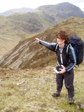
Fortunately, this section wasn't too long, giving me some comfort if something did go wrong. Leaving Grants, the trail quickly climbs atop a mesa and towards Mount Taylor, an inactive volcano whose 'peak' is now the highest point on the rim overlooking a massive crater, complete with an old cinder cone in the center. From the top, one can apparently see a third of the state. I found it particularly interesting that you can see weather patterns and duststorms from very far away due to the huge sight lines and all. The area around the peak is heavily forested, one of the first such stretches so far on the enire trail, due to the increased rainfall from the high altitude. There were also substantial patches of snow in the treed in areas, a taste of things to come in Colorado. We also encountered some of the best natural springs yet, which, particularly given the lack of water in New Mexico, are some of my favorite things ever. Cold, clear water that doesn't have to be filtered? And doesn't have cow crap surrounding it? Yes Please.
Following Mt Taylor, the trail necessarily goes downhill and traverses several lower desert areas interspersed with high mesas. The terrain is pretty awesome, with massive sand and mudstone cliffs rising suddenly in bands of red, orange and chalky white. The canyons at the bases of these areas show all sorts of erosion, from rounded, water carved rock, to pillars of crumbling mudstone surmounted by precariously balanced boulders, to huge overhangs pitted with smaller holes worn by the wind. The trail wends its way through all this, often climbing precipitously up the sides of cliffs in ways the AT or PCT never would, before abruptly leveling off. The tops of the mesas are like worlds of their own, more heavily wooded than the lowlands, thats makes one forget that you are hundreds of feet above the surrounding valley. The edge of these highlands can appear suddenly, a reminder of the altitude and the loneliness of the terrain.
The last leg into town was a tedious roadwalk, which seems to be the way of the trail out here. Thankfully there is less of that for the near future as the trail approaches Colorado. I don't plan on staying here in town, but there are quite a few stops in the coming days, so I won't be pushing too hard. Anyway, here's hoping the legs hold up, wishing the best for eveyone. Talk to you later.
Subscribe to:
Post Comments (Atom)
No comments:
Post a Comment