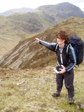
Hi all, writing today from Steamboat Springs, the last town stop in CO (woohoo!). After this, things are downhill for a bit, literally, as the trail heads into Wyoming and the Great Divide Basin, a huge desert where the divide splits apart, leaving a rain-shadowed depression where water is at a premium. I'm already reminiscing about the days of abundant streams and eating snow, though it will be nice to escape the touristy-ness (and expense) of the towns down here.
Once again I missed an update in Grand Lakes, so I'll try to make up for things here. The path from Silverthorne started out easy enough, but quickly became a challenging series of steep climbs with little real trail to speak of. It seemed to stick to the physical divide as much as possible, which makes for some crazy views, but also increases the difficulty as there was little tread to follow; often one is walking one talus and loose scree for long stretches, making for slow and tiring going. Furthermore, the water sources are often far below the track, making for uncertain rehydration, which is always important at altitude anyway. Lastly, it also increases the danger from thunderstorms, particularly in the summer. I have lucked out for the most part and was only held up by weather on the ridge once so far, but it always pays to be cautious in those circumstances. The last leg into Grand Lakes was particularly interesting, as I went from a campsite above treeline at 13,000 feet overlooking the lights of Denver one night, along a cloud-shrouded ridge the next morning, and down to a series of large lakes at (relatively) low elevation that afternoon. I was even treated to some free food and good conversation at the Little Moose Trading Post, a small campground store that hooks up the thru hikers as they pass on towards more civilization.
The final jump into Grand Lakes was a bit of a downer, unfortunately, as a particular stretch is inundated with downed trees, the continuing result of a massive infestation of invasive bark beetles that has affected the whole state. The trail was completely wiped out, and fighting through the tangle of debris and shrubery was an arduous task that sapped yet more time. I'd say it would be nice to see it cleared sooner, but given that the state is busy fighting several massive forest fires, that probably isn't high on their to-do list. Fortunately, Grand Lakes more than made up fo the difficulty as I stayed at the awesome Shadowcliff Lodge and Hostel, situated in a massive wooden building above the town and overlooking the several lakes in the area. At only $23 a night for a bunk, it was a pretty sweet deal. I even got to tag along with the staff when they went to a nearby hotspring in a ravine, complete with a great cliff jumping spot. Good times.
Leaving town, the trail gives hikers a decision; either take the expedient route, which heads straight northwest, or take a long, scenic loop through Rocky Mountain Nation Park which is directly adjacent to the hostel. Not one to pass up exploring a good view, I took the long way. It heads one creek, passing meadows and waterfalls on the way, tops out on aptly named Flattop Mountain, and heads down another drainage much like the first. The most striking sight was the huge clouds seen on the horizon from the Fort Collins fire burning to the northeast. Thankfully, the prevailing winds and several barren ridges seperated us from the conflagration, but a helpful woman in town reminded me of the danger of getting caught in a sudden, lightning induced fire. Thanks bunches!
Ironically, once out of the park the trail takes a quick turn for the worst as it heads through several clear cut areas. Its a jarring juxtaposition, one that mercifully only lasts for several miles. Once back on the divide, the views open up again, giving some last views back towards the lakes and the park beyond. The next few days were another series of strenuous up and downs oscillating above treeline. The climb up Parkview Mountain in particular was a butt kicker, but I was treated with several amazing ridgetop campsites that offered perfect sunrise views. The real highlight however was a rare mountain lion sighting a few mornings ago. Even though I only saw him for a second before he booked into the trees, it was awesome to finally see such an elusive creature, particularly when one sees signs of their comings and goings so often. Regardless of what I know about them, and their extreme reluctance to attack adult humans, I still found myself looking over my shoulder for the next few miles.
The last bit here into Steamboat Springs offered fewer things to be rave about, unfortunately. As the trail leaves the high mountains, it once again encounters private ranchland, which supersceded the desire of hikers and resulting in some ugly reroutes; the path to town includes many miles of asphalt walking. It seems that I am in for some more long stretches of road from here into southern WY before the real funs begins again in the Wind River Range and Yellowstone beyond. For the moment I am enjoying this last luxurious town stay, but much still awaits. Next stop is Rawlins, 150 miles or so away, talk to you all later!
Friday, June 22, 2012

Thursday, June 14, 2012
Silverthorne or Bust
Hi all, writing today from scenic Silverthorne, CO, where I have been lucky enough to stay with a family friend, Rebekah, older sister to David whom I crashed with in Albequerque while rehabilitating from my injury (which seems like forever ago already). Basically, karma dictates that I hook the Jordan family up with some hardcore hospitality at some point, so hopefully I'll be able to return the favor next time they come back East. The help was particularly appreciated given the layout of the town, (or towns really, seeing as Silverthorne, Frisco, Dillon and Breckenridge seem to run together pretty fluidly) which definitely has all the services a hiker could need, but is a little spread out for easy access. Having a car available takes much of the stress out of getting resupplied and all. The area is pretty spectacular, with several 14,000 foot peaks ringing a huge reservoir which the towns surround, and the hike in was fairly relaxed knowing I would get to spend some time in a real bed. In fact, the whole trek from my last town was very enjoyable, and I'll be sad to exit Colorado for the drier climes of Wyoming in a few weeks.
Leaving Salida was somewhat difficult, partly for the fact that the highway is a fair distance from downtown where I stayed, and partly because the place was so damn convenient. After hitching half way with an opera singer-slash-secretary, and the rest of the way with a former professional hangliding racer turnered writer and gold prospector, I finally got back on trail at Monarch Pass. The tread was rather easy for a few days as the path now seems to follow a rhythm of tough climbs followed by long stretches following a ridge or traversing a mountain at contour, often through pine and aspen groves. It passes the remains of an old mining town, now converted to backcountry cabins, as well as several packed trailheads indicating the start of summer and the flood of day hikers soon to be swarming the trails. Luckily the remoter places are still largely deserted, with largely unobstructed views from the tops of high passes down to snow dotted alpine lakes.
The highlight of this last stretch was Mt Elbert, which at 14,400 feet is the highest peak in Colorado and second only to Mt Whitney in altitude in the continental US. The trail leaves from Twin Lakes, a large reservoir with a postage stamp sized village mainly comprised of a general store and gas station, then climbs the south flank of the mountain, quickly ascending above treeline. I made a very windy camp about a quarter of the way up and continued early the next day, arriving at the top shortly after sunrise, finding two other hikers already at the summit. They had walked through the night to get there and were warming snow for water with their stoves, and for a short while we had the place to ourselves. With the sun up and the sky clear, things warmed up quickly and made for some amazing views back down towards the lake and the surrounding ranges. On the descent I encountered an increasing stream of peak baggers in various states of exhaustion and preparedness; I stopped counting at 75, and there were probably double that all told. It was a fun if tiring 4,000 foot scramble that left my knees and quads shaking, and I was glad for some relatively flat hiking afterwards.
The next goal was Copper Mt, a full sized ski resort with hotels, tons of shops, and some restaurants... almost all of which were closed due to my arriving before their summer season began. After hitting up the ice cream store, I headed up and over some passes towards the Silverthorne area, passing around the headwaters of some pristine streams and near an impressive waterfall crowded with hikers from town. I did stop to talk to 2 PCTers whom hiked in '10, the same year I had, so we reminisced for awhile before parting ways. I also gleaned some unfortunate information from some southbound Colorado Trail hikers concerning Greg, my hiking companion from Pagosa Springs to Lake City; apparently he got off trail in Salida and went home to Seattle for some reason for an indeterminate amount of time... which generally means for the rest of the season. Apparently I'm not the only one who found leaving that town difficult. As always, getting momentum leaving civilization is one of the hardest parts of thru hiking, and here is no different. On that note, I should get going; the trail won't hike itself! Talk to you later.
Leaving Salida was somewhat difficult, partly for the fact that the highway is a fair distance from downtown where I stayed, and partly because the place was so damn convenient. After hitching half way with an opera singer-slash-secretary, and the rest of the way with a former professional hangliding racer turnered writer and gold prospector, I finally got back on trail at Monarch Pass. The tread was rather easy for a few days as the path now seems to follow a rhythm of tough climbs followed by long stretches following a ridge or traversing a mountain at contour, often through pine and aspen groves. It passes the remains of an old mining town, now converted to backcountry cabins, as well as several packed trailheads indicating the start of summer and the flood of day hikers soon to be swarming the trails. Luckily the remoter places are still largely deserted, with largely unobstructed views from the tops of high passes down to snow dotted alpine lakes.
The highlight of this last stretch was Mt Elbert, which at 14,400 feet is the highest peak in Colorado and second only to Mt Whitney in altitude in the continental US. The trail leaves from Twin Lakes, a large reservoir with a postage stamp sized village mainly comprised of a general store and gas station, then climbs the south flank of the mountain, quickly ascending above treeline. I made a very windy camp about a quarter of the way up and continued early the next day, arriving at the top shortly after sunrise, finding two other hikers already at the summit. They had walked through the night to get there and were warming snow for water with their stoves, and for a short while we had the place to ourselves. With the sun up and the sky clear, things warmed up quickly and made for some amazing views back down towards the lake and the surrounding ranges. On the descent I encountered an increasing stream of peak baggers in various states of exhaustion and preparedness; I stopped counting at 75, and there were probably double that all told. It was a fun if tiring 4,000 foot scramble that left my knees and quads shaking, and I was glad for some relatively flat hiking afterwards.
The next goal was Copper Mt, a full sized ski resort with hotels, tons of shops, and some restaurants... almost all of which were closed due to my arriving before their summer season began. After hitting up the ice cream store, I headed up and over some passes towards the Silverthorne area, passing around the headwaters of some pristine streams and near an impressive waterfall crowded with hikers from town. I did stop to talk to 2 PCTers whom hiked in '10, the same year I had, so we reminisced for awhile before parting ways. I also gleaned some unfortunate information from some southbound Colorado Trail hikers concerning Greg, my hiking companion from Pagosa Springs to Lake City; apparently he got off trail in Salida and went home to Seattle for some reason for an indeterminate amount of time... which generally means for the rest of the season. Apparently I'm not the only one who found leaving that town difficult. As always, getting momentum leaving civilization is one of the hardest parts of thru hiking, and here is no different. On that note, I should get going; the trail won't hike itself! Talk to you later.
Thursday, June 7, 2012
Slowly in Salida
Hi everybody, writing today from lovely Salida, CO. I was lazy and managed to miss posting in Lake City, so I'll try and make up for it here.
The trip from Pagosa Springs to Lake City was a fairly challenging one. Knowing this in advance, Greg, the other thru hiker in town, and I decided to make the 115 hike together, so we hitched out and hit the trail. Very soon after departing we started running into long stretches of snow that had the annoying tendency to soften up early in the day, resulting in yet more postholing. As the days went by however, the snow started to suncup, forming into shallow bowls that herald the start of the real thaw. While this provided its own challenge in terms of hiking for us, it means that anyone traveling through just a few days after will probably have it free and clear. Dang. Still, as the suncups progress they acquire a beauty of their own, resembling waves and spines of snow that give the odd impression walking over a flash-frozen ocean.
The terrain was another challenge through this first section, with many ups and downs that lacked switchbacks to make the going easier. At times it felt more like the Appalachian trail, with its brutal straight up climbs, only this time at 13,000 feet. Luckily the views more than made up for the hardship, as the sparse vegetation means near constant views for dozens of miles. The sight distance was somewhat limited by a haze produced by forest fires in New Mexico, and at one point we could see smoke billowing just over a neighboring ridge, but all in all the sights were spectacular. One highlight was "The Window", a perfectly square notch knocked out of an escarpment above the trail, as well as the headwaters of the Rio Grande. The terrain gradually became more gentle as we headed down to Spring Creek Pass and the way into town, where a 2 and a half hour hitch put a slight damper on our spirits.
Lake City was a nice respite from the trials of the previous days, particularly since a new hostel had just opened up there. Greg and I were the first hikers to stay there, and in fact he knew the owner, Lucky, from his PCT thru hike in 2006. Lucky, an Irishman of course, had since gotten married, had 2 kids, 4 dogs, and a mortgage, but retained his hiking spirit and was happy to give us info about the trail in the area. The town was awesome for hikers being quaint, compact, and generally nice smelling (there were lots of lilacs, what can I say.) It is nestles in a narrow river valley, giving it a very sheltered feeling, and seeing as we were there slightly before tourist season, wasn't very crowded either. Greg decided to stay another day to heal his feet, which were rubbed raw due to the wet conditions, but I got a ride out with Lucky and continued north.
The trail to Salida has been suspiciously easy compared to the last stretch. This might just be due to increasing snow melt, but the trail itself has been pretty tame, thanks to the fact that it runs congruent to the well-maintained Colorado Trail. It generally climbs up to the divide, then follows the ridges on contour, meaning less strenuous up and down. There has been more vegetation, including a smattering of aspens which add some nice contrast to the pine forests up here. As always, the views are beautiful when the path clears out, revealing more snow capped mountains in the distance that hint at future trials to come. It has been nice hiking alone again, as Greg and I had a very different pace to our days, but the loneliness does add a further challenge to combat. Luckily, with the start of the summer season and the entrance into more populated parts of the state, there have been many more day hikers to interact with and pump for info regarding conditions north of here.
Salida itself is great, easily living up to its reputation as one of the best trail towns. While the whole city itself is relatively spread out, all the hiker needs are centered in the small historic district which is crammed full of restaurants, bars, an outfitter, a Safeway, the library and the PO. All of life's needs as far as we are concerned. There is even a river complete with whitewater rafting runs going straight through town; it reminds me a little of Bend, OR, in its outdoorsiness. Sadly, I'll have to be hiking out soon, but given that the next stretch looks pretty idyllic, and that the town stops come very frequently for a little bit, I'm not too worried. Anyway, time to hit the trail, talk to you later.
The trip from Pagosa Springs to Lake City was a fairly challenging one. Knowing this in advance, Greg, the other thru hiker in town, and I decided to make the 115 hike together, so we hitched out and hit the trail. Very soon after departing we started running into long stretches of snow that had the annoying tendency to soften up early in the day, resulting in yet more postholing. As the days went by however, the snow started to suncup, forming into shallow bowls that herald the start of the real thaw. While this provided its own challenge in terms of hiking for us, it means that anyone traveling through just a few days after will probably have it free and clear. Dang. Still, as the suncups progress they acquire a beauty of their own, resembling waves and spines of snow that give the odd impression walking over a flash-frozen ocean.
The terrain was another challenge through this first section, with many ups and downs that lacked switchbacks to make the going easier. At times it felt more like the Appalachian trail, with its brutal straight up climbs, only this time at 13,000 feet. Luckily the views more than made up for the hardship, as the sparse vegetation means near constant views for dozens of miles. The sight distance was somewhat limited by a haze produced by forest fires in New Mexico, and at one point we could see smoke billowing just over a neighboring ridge, but all in all the sights were spectacular. One highlight was "The Window", a perfectly square notch knocked out of an escarpment above the trail, as well as the headwaters of the Rio Grande. The terrain gradually became more gentle as we headed down to Spring Creek Pass and the way into town, where a 2 and a half hour hitch put a slight damper on our spirits.
Lake City was a nice respite from the trials of the previous days, particularly since a new hostel had just opened up there. Greg and I were the first hikers to stay there, and in fact he knew the owner, Lucky, from his PCT thru hike in 2006. Lucky, an Irishman of course, had since gotten married, had 2 kids, 4 dogs, and a mortgage, but retained his hiking spirit and was happy to give us info about the trail in the area. The town was awesome for hikers being quaint, compact, and generally nice smelling (there were lots of lilacs, what can I say.) It is nestles in a narrow river valley, giving it a very sheltered feeling, and seeing as we were there slightly before tourist season, wasn't very crowded either. Greg decided to stay another day to heal his feet, which were rubbed raw due to the wet conditions, but I got a ride out with Lucky and continued north.
The trail to Salida has been suspiciously easy compared to the last stretch. This might just be due to increasing snow melt, but the trail itself has been pretty tame, thanks to the fact that it runs congruent to the well-maintained Colorado Trail. It generally climbs up to the divide, then follows the ridges on contour, meaning less strenuous up and down. There has been more vegetation, including a smattering of aspens which add some nice contrast to the pine forests up here. As always, the views are beautiful when the path clears out, revealing more snow capped mountains in the distance that hint at future trials to come. It has been nice hiking alone again, as Greg and I had a very different pace to our days, but the loneliness does add a further challenge to combat. Luckily, with the start of the summer season and the entrance into more populated parts of the state, there have been many more day hikers to interact with and pump for info regarding conditions north of here.
Salida itself is great, easily living up to its reputation as one of the best trail towns. While the whole city itself is relatively spread out, all the hiker needs are centered in the small historic district which is crammed full of restaurants, bars, an outfitter, a Safeway, the library and the PO. All of life's needs as far as we are concerned. There is even a river complete with whitewater rafting runs going straight through town; it reminds me a little of Bend, OR, in its outdoorsiness. Sadly, I'll have to be hiking out soon, but given that the next stretch looks pretty idyllic, and that the town stops come very frequently for a little bit, I'm not too worried. Anyway, time to hit the trail, talk to you later.
Saturday, May 26, 2012
San Juan Slog
Hi all, writing today from Pagosa Springs, CO, a lovely little town that seems to be indicative of what most of the supply stops in this state will be like; quaint, touristy and more upscale than those in New Mexico, for better or worse. Everything is arranged along the bucolic San Juan River, and true to its name the place is full of hot springs fed spas interspersed with cafes and the like. More importantly for the hiker, its all fairly compact, so getting around is rather easy. The drive down from Wolf Creek Pass was spectacular as well, as highway 160 winds thousands of feet down to the valley floor, though a nearby forest fire smogged up the air a bit. Luckily, I got a hitch easily with a doctor/ rock climber named Jay who also treated me to some coffee in town. I still haven't decided whether I'll stay here tonight, but given that day passes to the springs are cheap and there is a fair in town tonight, chances are I'll elect to be lazy, again, and give the ole' knee some more rest.
The trail from Chama has been pretty much everything I had hoped and feared. The San Juan Mountains are beautiful in a stark way very different from the Sierras in California, with less trees and more barren grassland up high, though perhaps that is more due to the lack of snow. Wind has been the most persistent phenomena, as it seems to blow consistently all day and night at about 40 mph, with gusts up to twice that. Often I find myself leaning at a 60% angle just to stay upright, only to topple over when a brief lull comes by. Only the heavily forested sections can give any respite. This is probably because the path tends to go up along the ridges and only drop to the valleys when absolutely necessary, but even then it never drops below 10,000 feet. There have been several astounding views as the trail circles high above the headwaters of several rivers, as well a some cloud-bound peaks clad in stone covered sheets of snow, the proof or erosion in progress. And all throughout the background are the ever present mountains, harbingers of climbs to come.
Fortunately, this has been a very low snow year, so the going is a bit easier than it might otherwise have been, but even with only about 10% ground cover, it can still be agonizingly slow going sometimes. It has a different consistency than Sierra snow, being much looser and lighter, thus a small snowfield can turn into an exhausting slog through ice-crusted slush up to your waist. As usual, forested areas and north facing slopes are the worst, and trail that traverses these areas is frequently buried and dangerous or tiring to navigate. As an example, I elected to drop about 1,200 feet down a precipitous slope and hike up a valley floor, as opposed to traversing its length through snow at a higher elevation. It required a much bigger loss and gain of altitude, as well as a near suicidal descent that was more like a controlled human avalanche, but in the end it felt worth it. In the end, all the toil feels worth it of course (though one wouldn't know it given my epic bouts of swearing in the middle of the more draining postholing marathons), but it sure feels nice to be in town for a bit. With that, I'll talk to you all later.
The trail from Chama has been pretty much everything I had hoped and feared. The San Juan Mountains are beautiful in a stark way very different from the Sierras in California, with less trees and more barren grassland up high, though perhaps that is more due to the lack of snow. Wind has been the most persistent phenomena, as it seems to blow consistently all day and night at about 40 mph, with gusts up to twice that. Often I find myself leaning at a 60% angle just to stay upright, only to topple over when a brief lull comes by. Only the heavily forested sections can give any respite. This is probably because the path tends to go up along the ridges and only drop to the valleys when absolutely necessary, but even then it never drops below 10,000 feet. There have been several astounding views as the trail circles high above the headwaters of several rivers, as well a some cloud-bound peaks clad in stone covered sheets of snow, the proof or erosion in progress. And all throughout the background are the ever present mountains, harbingers of climbs to come.
Fortunately, this has been a very low snow year, so the going is a bit easier than it might otherwise have been, but even with only about 10% ground cover, it can still be agonizingly slow going sometimes. It has a different consistency than Sierra snow, being much looser and lighter, thus a small snowfield can turn into an exhausting slog through ice-crusted slush up to your waist. As usual, forested areas and north facing slopes are the worst, and trail that traverses these areas is frequently buried and dangerous or tiring to navigate. As an example, I elected to drop about 1,200 feet down a precipitous slope and hike up a valley floor, as opposed to traversing its length through snow at a higher elevation. It required a much bigger loss and gain of altitude, as well as a near suicidal descent that was more like a controlled human avalanche, but in the end it felt worth it. In the end, all the toil feels worth it of course (though one wouldn't know it given my epic bouts of swearing in the middle of the more draining postholing marathons), but it sure feels nice to be in town for a bit. With that, I'll talk to you all later.
Tuesday, May 22, 2012
No Mas New Mexico
Chama-Chama-Chama-Chameleon. Sorry, the brain does wierd things while wandering around out here. So, I've made it to Chama, in case that wasn't obvious, and in doing so am officially done with New Mexico. The trail passes out of the state near Cumbres Pass, though the town itself is actually back across the border... sigh, NM just doesn't like letting go.
It certainly feels like a different state however, for the scenery changes drastically after leaving Ghost Ranch. While there had been scattered areas of snow and patches of green at the higher elevations before, everything is now verdant in all directions. There have been multiple high meadows full of blooming dandelions and wild irises, as well as some drier plateaus populated by elk, pronghorn antelope and coyotes. These give way to pine and aspen forests, providing some much needed shade and protection from the wind, which can lower the temperature pretty quickly even on sunny days. Snow drifts and mountain streams abound, making water access a non issue for once, and lightening the pack load even if it is somewhat balanced out by the extra warm weather gear I'll be carrying.
The section north of here supposedly starts to get quite a bit more difficult, with weather and snow travel becoming an issue. Elinor, who I was hiking with before my knee injury, apparently got dumped on with hail near here and her tent collapsed, so here's hoping I miss that bit of adventure. Pagosa Springs is the next stop, just trying to take things one step at a time here, so the push must continue on. Talk to everyone later!
It certainly feels like a different state however, for the scenery changes drastically after leaving Ghost Ranch. While there had been scattered areas of snow and patches of green at the higher elevations before, everything is now verdant in all directions. There have been multiple high meadows full of blooming dandelions and wild irises, as well as some drier plateaus populated by elk, pronghorn antelope and coyotes. These give way to pine and aspen forests, providing some much needed shade and protection from the wind, which can lower the temperature pretty quickly even on sunny days. Snow drifts and mountain streams abound, making water access a non issue for once, and lightening the pack load even if it is somewhat balanced out by the extra warm weather gear I'll be carrying.
The section north of here supposedly starts to get quite a bit more difficult, with weather and snow travel becoming an issue. Elinor, who I was hiking with before my knee injury, apparently got dumped on with hail near here and her tent collapsed, so here's hoping I miss that bit of adventure. Pagosa Springs is the next stop, just trying to take things one step at a time here, so the push must continue on. Talk to everyone later!
Friday, May 18, 2012
Ghosts of Artists Past
Hi all, writing today from Ghost Ranch, NM, a resort most well know for hosting Georgia O'Keefe in her prime. Naturally, the view is pretty spectacular, with everything tucked away into a valley coming down off a multicolored mesa, and adobe structures fronting a green swath of hay fields. Aside from the usual cabins and such, there is also a large mess hall (all you can eat meals, huzzah!), a palentology and archaeology museum, guided tours of all things O'Keefe related, a bluegrass festival, and some sort of school outing. All in all, it feels more crowded here than it has even in the towns, but it is relaxing either way. Given that the next major town, Chama, is only 44 miles away, and that I need to pick up packages at the post office, which will be closed by the time I get there if I leave today, I figure I'll chill here for the night and let my knee continue to heal.
Seeing as the hike from Cuba was so short, one would think there would not be much of interest. Instead, this last section was a bit of a surprise as the path climbs to over 10,000 feet over the San Pedro range. The vegetation quickly turns into dense pines at that height, and we saw our first real signs of lingering snow cover. In that sense, the long delay in Grants might have been a good thing; 2 weeks ago this area was much more blanketed. Now, however, the high meadows that the trail crosses near the peak are simply flooded, creating wide open marshes that require getting your boots wet to cross. Ugh. Fortunately, these areas aren't too far across, and give nice views complete with small groups of elk off in the distance. Upon coming down from the mountain, the terrain quickly turns drier and heads off to yet another colorful mesa before crossing the Chama River and heading towards the ranch.
There has finally been some other hiker info to report. Gale, another thru hiker is here as well, though on her way out for the moment; she hiked part of the trail last year and is going to flip up to finish some bits she missed then. A few other guys who passed me by while I was in Albaquerque also showed up briefly, as they had just taken some time off in Santa Fe. They seemed pretty determined, but having been down that road before, constantly racing with one another and pushing all day long, I don't really envy them. With so few people on the trail, its much easier to relax and take time to enjoy the sights, even if motivation is more of an issue when your boots freeze, etc.
Lastly, Crystal, Celine, and Frog should be showing up tonight. Only Crystal is human (and a French one at that). Celine and Frog are her two mules that she has bought along the way here, and they are her riding and pack animals, respecitvely. We've been hearing about them right since the get go, so it was nice to finally meet up and put a face to all the trail rumors. Even on a path as sparsely populated as this one, news has a way of getting around. Anyway, going to hit up the shower and hopefully do some laundry, talk to you all later.
Seeing as the hike from Cuba was so short, one would think there would not be much of interest. Instead, this last section was a bit of a surprise as the path climbs to over 10,000 feet over the San Pedro range. The vegetation quickly turns into dense pines at that height, and we saw our first real signs of lingering snow cover. In that sense, the long delay in Grants might have been a good thing; 2 weeks ago this area was much more blanketed. Now, however, the high meadows that the trail crosses near the peak are simply flooded, creating wide open marshes that require getting your boots wet to cross. Ugh. Fortunately, these areas aren't too far across, and give nice views complete with small groups of elk off in the distance. Upon coming down from the mountain, the terrain quickly turns drier and heads off to yet another colorful mesa before crossing the Chama River and heading towards the ranch.
There has finally been some other hiker info to report. Gale, another thru hiker is here as well, though on her way out for the moment; she hiked part of the trail last year and is going to flip up to finish some bits she missed then. A few other guys who passed me by while I was in Albaquerque also showed up briefly, as they had just taken some time off in Santa Fe. They seemed pretty determined, but having been down that road before, constantly racing with one another and pushing all day long, I don't really envy them. With so few people on the trail, its much easier to relax and take time to enjoy the sights, even if motivation is more of an issue when your boots freeze, etc.
Lastly, Crystal, Celine, and Frog should be showing up tonight. Only Crystal is human (and a French one at that). Celine and Frog are her two mules that she has bought along the way here, and they are her riding and pack animals, respecitvely. We've been hearing about them right since the get go, so it was nice to finally meet up and put a face to all the trail rumors. Even on a path as sparsely populated as this one, news has a way of getting around. Anyway, going to hit up the shower and hopefully do some laundry, talk to you all later.
Wednesday, May 16, 2012
No Mojitos in Cuba
Hi all, writing today from Cuba, NM, where, as the title says, there is nary a beachfront bar in sight. It has been described as "sketchy", so I don't think I'll be spending much time here, but in full daylight it doesn't seem too bad. There are, however, a hilarious number of prarie dogs running around outside the library windows, so theres that.
The big issue this section has obviously been my knee and its back and forth state of distress. Its held up fairly well in the intervening 110 miles from Grants, which included a fair number of ups and down that added quite a bit of stress to the situation. Thankfully it seems to be recovering on the whole, though how it holds up over several weeks will be the real test of things. For now, its more a matter of rebuilding strength and stamina; taking 2 weeks off pretty much put me back to square one in that regard. Heres hoping that was the one and only setback on this little trip.
Fortunately, this section wasn't too long, giving me some comfort if something did go wrong. Leaving Grants, the trail quickly climbs atop a mesa and towards Mount Taylor, an inactive volcano whose 'peak' is now the highest point on the rim overlooking a massive crater, complete with an old cinder cone in the center. From the top, one can apparently see a third of the state. I found it particularly interesting that you can see weather patterns and duststorms from very far away due to the huge sight lines and all. The area around the peak is heavily forested, one of the first such stretches so far on the enire trail, due to the increased rainfall from the high altitude. There were also substantial patches of snow in the treed in areas, a taste of things to come in Colorado. We also encountered some of the best natural springs yet, which, particularly given the lack of water in New Mexico, are some of my favorite things ever. Cold, clear water that doesn't have to be filtered? And doesn't have cow crap surrounding it? Yes Please.
Following Mt Taylor, the trail necessarily goes downhill and traverses several lower desert areas interspersed with high mesas. The terrain is pretty awesome, with massive sand and mudstone cliffs rising suddenly in bands of red, orange and chalky white. The canyons at the bases of these areas show all sorts of erosion, from rounded, water carved rock, to pillars of crumbling mudstone surmounted by precariously balanced boulders, to huge overhangs pitted with smaller holes worn by the wind. The trail wends its way through all this, often climbing precipitously up the sides of cliffs in ways the AT or PCT never would, before abruptly leveling off. The tops of the mesas are like worlds of their own, more heavily wooded than the lowlands, thats makes one forget that you are hundreds of feet above the surrounding valley. The edge of these highlands can appear suddenly, a reminder of the altitude and the loneliness of the terrain.
The last leg into town was a tedious roadwalk, which seems to be the way of the trail out here. Thankfully there is less of that for the near future as the trail approaches Colorado. I don't plan on staying here in town, but there are quite a few stops in the coming days, so I won't be pushing too hard. Anyway, here's hoping the legs hold up, wishing the best for eveyone. Talk to you later.
The big issue this section has obviously been my knee and its back and forth state of distress. Its held up fairly well in the intervening 110 miles from Grants, which included a fair number of ups and down that added quite a bit of stress to the situation. Thankfully it seems to be recovering on the whole, though how it holds up over several weeks will be the real test of things. For now, its more a matter of rebuilding strength and stamina; taking 2 weeks off pretty much put me back to square one in that regard. Heres hoping that was the one and only setback on this little trip.
Fortunately, this section wasn't too long, giving me some comfort if something did go wrong. Leaving Grants, the trail quickly climbs atop a mesa and towards Mount Taylor, an inactive volcano whose 'peak' is now the highest point on the rim overlooking a massive crater, complete with an old cinder cone in the center. From the top, one can apparently see a third of the state. I found it particularly interesting that you can see weather patterns and duststorms from very far away due to the huge sight lines and all. The area around the peak is heavily forested, one of the first such stretches so far on the enire trail, due to the increased rainfall from the high altitude. There were also substantial patches of snow in the treed in areas, a taste of things to come in Colorado. We also encountered some of the best natural springs yet, which, particularly given the lack of water in New Mexico, are some of my favorite things ever. Cold, clear water that doesn't have to be filtered? And doesn't have cow crap surrounding it? Yes Please.
Following Mt Taylor, the trail necessarily goes downhill and traverses several lower desert areas interspersed with high mesas. The terrain is pretty awesome, with massive sand and mudstone cliffs rising suddenly in bands of red, orange and chalky white. The canyons at the bases of these areas show all sorts of erosion, from rounded, water carved rock, to pillars of crumbling mudstone surmounted by precariously balanced boulders, to huge overhangs pitted with smaller holes worn by the wind. The trail wends its way through all this, often climbing precipitously up the sides of cliffs in ways the AT or PCT never would, before abruptly leveling off. The tops of the mesas are like worlds of their own, more heavily wooded than the lowlands, thats makes one forget that you are hundreds of feet above the surrounding valley. The edge of these highlands can appear suddenly, a reminder of the altitude and the loneliness of the terrain.
The last leg into town was a tedious roadwalk, which seems to be the way of the trail out here. Thankfully there is less of that for the near future as the trail approaches Colorado. I don't plan on staying here in town, but there are quite a few stops in the coming days, so I won't be pushing too hard. Anyway, here's hoping the legs hold up, wishing the best for eveyone. Talk to you later.
Subscribe to:
Posts (Atom)